Here’s a weather video from the Mojave Desert in California, we’d taken a fine hike in Joshua Tree National Park and found ourselves on the summit of Warren Peak. At the summit there was a righteous wind blowing in from the southwest.
There are plenty of clouds in this video, and even a contrail to the northeast. Out to the east there is ample blue sky and I suspect it’s a fine day in that part of the Mojave. But the weather is awful to the west and northwest. The top of the San Jacinto and the San Bernardino mountains are completely socked in, even at lower elevations like San Gorgonio Pass, home to a massive wind farm, the clouds are low.
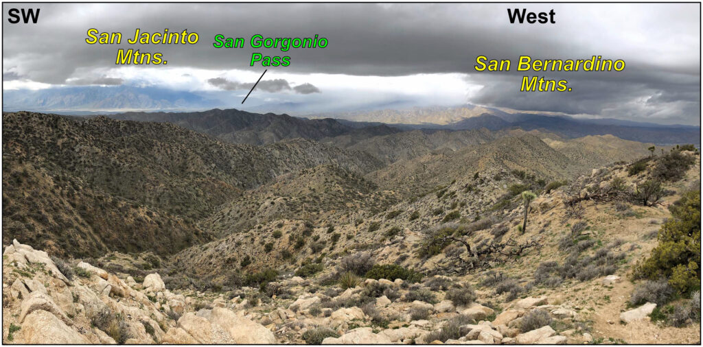
View of some dirty weather knocking about in the San Jacinto and San Bernardino mountains in southern California on March 6th, 2019.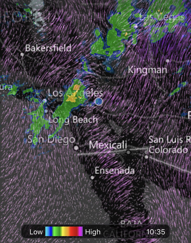
Screenshot of the precipitation and winds on March 6th, 2019 in the southern California region.On this early spring day, a cold front was rolling into southern California, bringing with it an icky rain to Los Angeles and snow to the higher elevations in the Transverse Ranges. But this high topography, with peaks above 3350 meters (11,000’), was wringing out the Pacific moisture before it ever reached the Mojave Desert. Mountains ranges the world over cause air to be lifted and adiabatically cooled on their windward side, and then produce rain shadows on the leeward side of that topography.
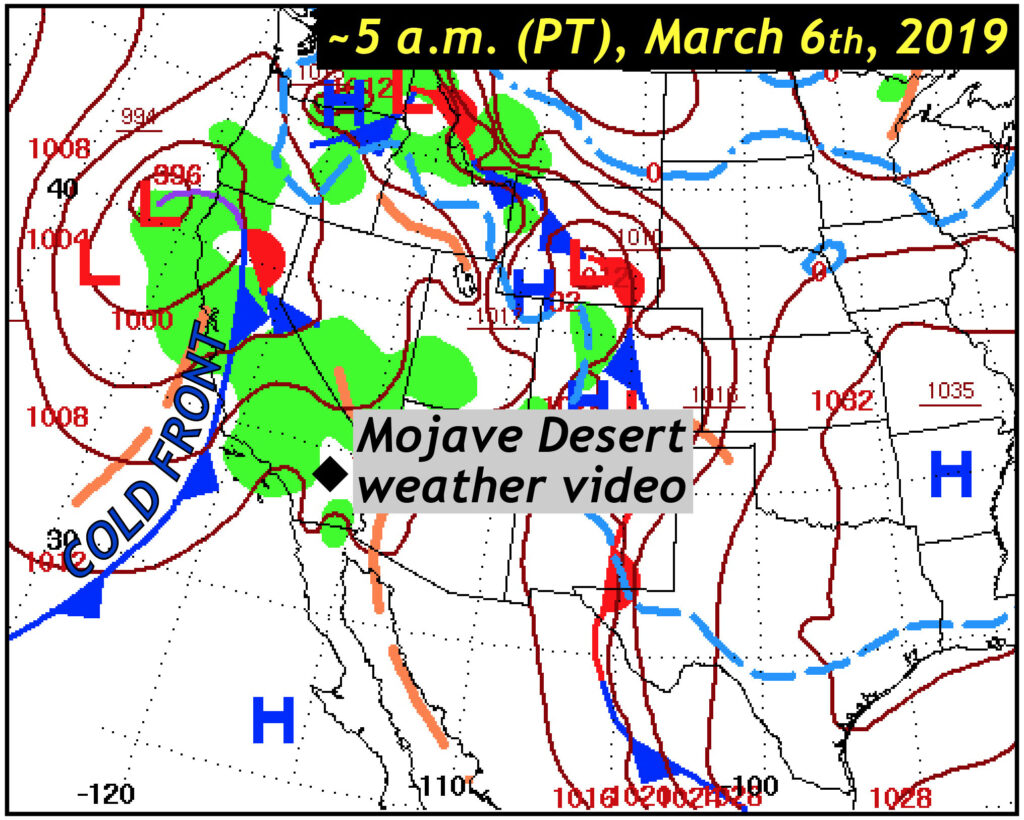
National Weather Service synoptic weather map for the early hours of March 6th, 2019. A cold front is sliding into California. The green illustrates areas experiencing precipitation.This colorful map by Chelsea McRaven Freeney neatly illustrates southern California’s average annual precipitation and the dramatic rain shadow to the east of the Sierra Nevada, Transverse Ranges, and Peninsular Ranges.
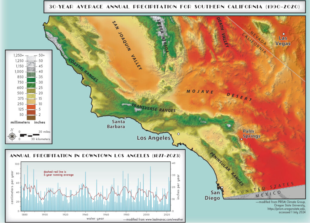
Precipitation map for southern California, modified from PRISM Climate Group (Oregon State University). The warm colors in the Mojave Desert are <250 mm/year whereas the green color in the mountainous terrain corresponds to >600 m/year. Map from Freeney, C.M., 2024, GSA Connects 2024 — Southern California Geo-Sites: Geological Society of America and Mountain Press, GSA Maps and Charts MCH107The geology on the hike to Warren Peak was also stunning, but I’ll save that for another day.